Each fiscal year of ACHF funding, a majority of the twelve regional library systems agree to allocate 10% of their ACHF funding to support statewide partnership projects. SELCO serves as the fiscal agent for statewide projects.
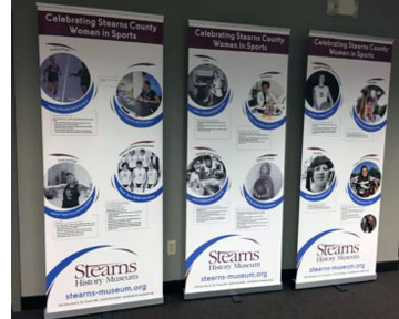
Stearns History Museum wrote the biographies of 25 identified women from Stearns County who have made a direct contribution to the history of sports and the passage and implementation of Title IX Education Amendments on June 23, 1972. The project addresses how the women's experiences influenced their lives and careers beyond athletics.
Source Water Protection is one of the three priority concerns identified in the Stearns Comprehensive Local Water Managment Plan. Currently, Stearns County has 23 public water supplies with approved Wellhead Protection Plans. This encompasses approximately 65,000 acres of land in Drinking Water Supply Management Areas (DWSMA). This proposal will fund at least 10 unused well sealing projects within these sensitive areas.
The Stearns County Soil and Water Conservation District's (SWCD) Stump and Sagatagan Lakes Subwatershed Stormwater Treatment Projects will retrofit sub-catchment drainage areas on St. John's University (SJU) campus that drain untreated stormwater runoff directly into Stump and Sagatagan Lakes. This area of the region has been identified as ecologically significant by the Nature Conservancy's Eco-Regional Plan and the MN DNR's County Biological Survey.
Stearns County Ditch 26 (CD 26) is a 20 mile channelized section of Getchell Creek, a primary tributary to the Sauk River that is impaired for turbidity, E.coli and aquatic macroinvertebrate bio-assessment. The Stearns County Ditch 26 Drainage Management Project will address the stormwater runoff concerns identified within this public drainage system. Alternative intake structures to manage nutrients and mitigative measures will be taken to retain water on the upland properties and minimize flow rate and velocity.
To repoint masonry and restore first floor façade and architectural details on the Stranger's Refuge Lodge #74 IOOF, listed in the National Register of Historic Places, to be reused as the public library.
Grants to counties to implement SSTS programs including inventories, enforcement, development of databases, and systems to insure SSTS maintenance and of reporting program results to BWSR and MPCA and base grants.
The project will work with county and Waseca Soil and Water Conservation District staff to increase knowledge and participation in the Watershed Approach efforts and provide input to the Watershed Restoration and Protection Strategies (WRAPS) document.
The Le Sueur Watershed Technician will provide highly focused targeting of conservation programs and practices in this key watershed. The technician will enhance current staff capabilities in the Le Sueur watershed by collecting landowner contact information, producing landowner mailings about funding opportunities, and meeting one-on-one with landowners to discuss conservation concerns they may have. This has been a highly successful method for targeting projects, project identification, landowner contact, and project follow through.
This project will complete a Acetochlor Impairment Response Report. This report will combine and coordinate information relating to actions being done in direct response to the acetochlor water quality impairments with those being done and support MDA’s on-going responsibility to assure pesticides are used in a manner that does not cause unreasonable adverse effects on the environment.
This project will provide additional monitoring data to be utilized in the watershed assessment process for the Le Sueur River Watershed Project. Monitoring will take place for an additional year at two sites along the Maple River.
This project will identify priority management zones (PMZ), for the purposes of water quality restoration and protection, within the LeSueur River major watershed. This project is only one component of a larger effort in the LeSueur watershed to complete Total Maximum Daily Load (TMDL) studies while engaging citizens and landowners in land management planning.
This project will assess lakes and streams in the Cannon River watershed that have not been assessed to determine if they are meeting their designated uses. Some of these lakes and streams have data for certain pollutants, but not enough to complete an impairment assessment. The river and stream reaches are located in Dakota, Goodhue, Le Sueur, Rice, Steele, and Waseca counties. The lakes are located throughout the Cannon watershed (Le Sueur, Rice and Waseca Counties). This project will be a continuation of past assessments conducted in 2007 and 2009.
This project will obtain a lake data set for Douglas County while fostering lake association participation, ownership, and understanding of their lakes. A better understanding of these lakes is necessary in order to meet goals established in the 2009-2019 Comprehensive Local Water Management Plan and enable 303(d) and 305(b) assessments. Lakes included in this project are: Agnes, Alvin, Blackwell, Brophy, Charley, Cook (Cork), Crooked (East), Crooked (NW), Echo, Henry, Lovera (Lovers), Mina, Round, and Spring.
Rice County Water Resources Division will complete a Surface Water Assessment for six lakes located in the Cannon River Watershed. The lakes chosen include: Sprague Lake (66-0045-00), Mud Lake (66-0054-00), Hatch Lake (66-0063-00), Pooles Lake (66-0046-00), Logue Lake (66-0057-00), and Phelps Lake (66-0062-00). Each lake chosen is currently unassessed, and both Sprague and Mud lake are priority lakes for testing. Sampling will include testing dissolved oxygen, temperature, pH, Secchi, Total phosphorus, and chlorophyll-a. The samples will be taken by volunteers and paid staff.
This project will be a joint effort between the Todd Soil & Water Conservation District (SWCD) and the Sylvan Shores residents. Todd SWCD will organize and coordinate the project in full partnership with the Sylvan Shores residents. The actual monitoring will be a cooperative effort between Todd SWCD staff and citizen volunteers at Fawn and Pine Island Lakes.
This area of the Minnesota River Basin has been identified as contributing significant amounts of sediment to the watershed. The primary cause of the sediment is from gullies and ravines. This project by the Greater Blue Earth River Basin Alliance (GBERBA) continues efforts begun with FY2011 Clean Water Funds. Using data collected through Geographic Information Systems (GIS) and LiDAR, GERBA will install best management practices to address severe ravines and gullies in targeted specific locations.
Turbidity and sediment yield from the Le Sueur River watershed to the Minnesota River is a problem. Studies have shown that 200,000 tons/yr come from non-field sources and 25,000 tons/yr come from field sources. With this grant we will develop strategies to reduce sediment yield from the Freeborn County Cobb River Ditch subwatershed.
With the proposed project, the Pomme de Terre River Association will target catchments delivering the highest 25% of sediment from agricultural land and identified priority management zones for storm water runoff (identified in the Watershed Restoration and Protection Strategy). Implementation is estimate to reduce sediment runoff to prioritized water bodies by 14,690 tons per year and phosphorous by 12,270 pounds per year.
To be able to manage resources in the Blue Earth and Le Sueur Watersheds into the future and have a positive effect on water quality, resource managers need high quality accurate data to support decision making of best management practice (BMP) implementation. Digital elevation data is a valuable resource for modeling water flow, however in its current state it cannot represent water conveyance through features such as roadways. These flow barriers limit the accurate use of data for recently developed targeting tools identifying BMP suitability and effectiveness down to the field scale.
A contractor with knowledge of Site Specific Standard development will respond to U.S. Environmental Protection Agency (EPA) questions and concerns regarding attainability of standards based on the BATHTUB model data. In addition, they will review technical memorandums developed by Minnesota Pollution Control Agency (MPCA) on aquatic life and aquatic recreational standard attainability.
RESPEC is a contractor with knowledge of site-specific standard development and will respond to United States Environmental Protection Agency questions and concerns regarding attainability of standards. The response will be based on bathtub model data and also a review of technical memorandums developed by the Minnesota Pollution Control Agency on aquatic life and aquatic recreational standard attainability.
The Sauk River watershed was selected to participate in the federal Mississippi River Basin Initiative (MRBI) program in 2010 to decrease nutrient contributions to the Mississippi River and the Gulf of Mexico. The MRBI program provides federal cost share funds to landowners to install conservation practices.
The Terrace grist mill was built in 1903. In 1967, the mill was abandoned. In 1979, the non-profit Terrace Mill Foundation was incorporated, purchased the mill and began a 30 year commitment to restoring and maintaining the mill and property.
The Foundation is managed by a volunteer board of directors. Today, the three story mill contains a circa 1900 general store, museum of mill artifacts, gift shop, historic media center, Pioneer Playhouse Theater and Wheeler Art Gallery. In July, 1979, the Terrace Mill District was placed on the National Registry of Historic Places.
The Greater Blue Earth River Basin Alliance (GBERBA), a nine County/SWCD JPO has identified buffers as a basin priority. This initiative will work towards the goal of identifying all DNR protected shoreland in the GBERBA counties without a 50 foot vegetative buffer. Buffer strips protect surface and groundwater from a multitude of pollutants. During stormwater run off events buffers can remove between 50 and 100 percent of nutrients, pesticides, pathogens, and sediment. The estimated sediment reduction for this project is 756 tons per year prevented from entering our waters.
Thiel Creek is a designated trout stream in southern Stearns County and outlets into Lake Marie and Lake Louisa. Both lakes are impaired for nutrients. Thiel Creek is experiencing severe bank erosion and local residents have expressed concern about the excessive sedimentation entering the lakes. Most of this erosion is occurring on an approximate mile reach of the creek just upstream of the outlet into the lake.


 Stearns History Museum wrote the biographies of 25 identified women from Stearns County who have made a direct contribution to the history of sports and the passage and implementation of Title IX Education Amendments on June 23, 1972. The project addresses how the women's experiences influenced their lives and careers beyond athletics.