Having current and accurate data on historic and archaeological sites is important to understanding our past and to preserving Minnesota’s history for future generations. In 2010-2011, the Minnesota Historical Society awarded contracts for these survey projects:
This project will support the MPCA’s water quality monitoring and assessment program. Specifically, the MPCA is developing a refined use designation process known as tiered aquatic life uses (TALU) to account for situations in which stream habitat has been compromised through hydrological alteration (e.g. channelization and ditching). An accurate state-wide determination of altered stream segments based upon the current National Hydrography Dataset (NHD) linework will assist in the assignment of the correct beneficial use within this new TALU framework.
A web-based map viewer, and will be made available to the public through the D.N.R. website (mndnr.gov). All non-state data will rely explicitly on outside resources collected by the University of Minnesota.
Map scale will guide the quantity and type of information available in print form. Legislation passed in 2009, Chapter 172, states the need for a printed map product, as well as a web-based interface that is available to the public. Facilities included on the general legislative printed map (or booklet) will be State and Regional parks, State and major Regional trails, State Forest Campgrounds and Day-Use Areas, and basic information on how to access more information on these facilities.
Nitrate-nitrogen (nitrate) is one of the contaminants of greatest concern for groundwater in Minnesota. This funding is being used for activities that help identify the severity and magnitude of nitrate contamination and implement practices at the local level to reduce nitrate in groundwater. The Minnesota Department of Agriculture (MDA) is working with many local partners and passing funding through to local government units (counties, cities, soil and water conservation districts) to address this concern.
The MDA's technical assistance helps ensure that current and accurate scientific information is made available and used to address water quality concerns in agricultural areas of Minnesota. This funding has been used to evaluate the effectiveness of conservation practices, share information from research and demonstration sites and enhance outreach and education to the agricultural community and local government partners.
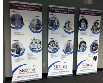
Stearns History Museum wrote the biographies of 25 identified women from Stearns County who have made a direct contribution to the history of sports and the passage and implementation of Title IX Education Amendments on June 23, 1972. The project addresses how the women's experiences influenced their lives and careers beyond athletics.
Source Water Protection is one of the three priority concerns identified in the Stearns Comprehensive Local Water Managment Plan. Currently, Stearns County has 23 public water supplies with approved Wellhead Protection Plans. This encompasses approximately 65,000 acres of land in Drinking Water Supply Management Areas (DWSMA). This proposal will fund at least 10 unused well sealing projects within these sensitive areas.
A consultant was hired to facilitate a process to grow the capacity of the organization to preserve and interpret history through a national training standard, known as StEPs. The StEPs program is an on-going process for continuous improvement.
In order to grow the capacity of the organization to preserve and interpret history a consultant was hired by the DCHV to lead selected members and the board through the Standards and Excellence Program for History Organizations' (StEPs) self-assessment program.
To grow the capacity of the organization to preserve and interpret history through a national training standard, the Firefighter's Hall and Museum completed four of six areas of the StEPs Program at the Bronze level. The areas completed were the Mission, Values and Governance, Management, Audience and Interpretation sections. The FHM does not have historic structures or landscapes so that area does not apply. The Collections area was too large to complete before the June deadline. The Museum plans to continue the StEPs work and the collections project is a top priority.
Archival storage boxes were purchased to re-house and properly store the city's historic collections located in the Kremer House Museum and Library. Steel storage shelves were purchased to house the boxes of photographs, newspapers and non-clothing items that are stored in the attic. Many volunteers assisted with the cleaning, organizing, boxing and labeling of items. The collections are now more accessible, including long forgotten and newly rediscovered items now available for use and/or reference as a result of this re-organization.
Partner Organizations: Anoka County Historical Society, Hennepin History Museum.
Suburbanization has reached nearly all corners of Hennepin and Anoka Counties. The two counties are bound together by the state's largest school district: Anoka-Hennepin. Working together, the Anoka and Hennepin County Historical Societies are gathering resources located in numerous repositories so that they, and future historians, will have a logical starting place from which to draw information about the suburbanization of Anoka and Hennepin counties.
This grant seeks to build the top 5 prioritized projects (2 iron-enhanced sand filters, 1 rain garden, 1 infiltration trench, and 1 tree trench) within the City of New London. Installation of these project will result in a cost-effective pollutant reduction from city runoff to various nearby water resources. The project is estimated to reduce sediment by 2 tons and phosphorus by 8 pounds annually.
Lebanon Hills Regional Park, realign visitor center entrance road, improve storm water management including flood mitigation and ecological health of adjacent wetland.
Stream flow information is essential for understanding the state of Minnesota's waters. Clean water funding has allowed the DNR to expand a network of stream gages that support planning and implementation for clean water protection and restoration. These gages are also used as part of the interagency Flood Forecasting/Warning System. This expanded stream gaging network has also significantly increased the real time data available to recreational water enthusiasts via the internet.
Erosion from streambanks and fields along the Clearwater River add sediment, nutrients and organic material to this important tributary of the Red River of the North. Turbidity impairments caused by those sediments contribute to several environmental and economic problems including interfering with spawning habitat critical to Lake Sturgeon recovery in the Red River Watershed and increasing drinking water treatment costs for the city of East Grand Forks.
This project will provide information and tools for a method to credit street sweeping that can be implemented by Municipal Separate Storm Sewer (MS4) permittees to help meet permit requirements for phosphorus and total suspended solids (TSS). The contractor will develop and submit a communication-outreach plan for the credit method.
Stubbs Bay on Lake Minnetonka is impaired for excess nutrients due to phosphorus loading. This impairment results in nuisance algae blooms that limit the recreational use of this water body. As a part of its surface water management planning process, the City of Orono has identified projects to help improve the water quality of Stubbs Bay and Lake Minnetonka. The Stubbs Bay Ravine Stabilization project is one of the projects scheduled for completion in 2011.


 Stearns History Museum wrote the biographies of 25 identified women from Stearns County who have made a direct contribution to the history of sports and the passage and implementation of Title IX Education Amendments on June 23, 1972. The project addresses how the women's experiences influenced their lives and careers beyond athletics.


